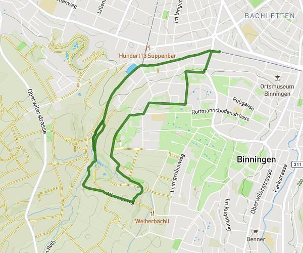
This running route covers 7.106mi starting from Zeiningen, Aargau. The run is a loop trail and returns to the trailhead. This run is rated as moderate, expect about 1h16m to complete it. The route has an elevation gain of 1677ft and an elevation loss of 1673ft.
Sonnenberg
Route details
5.59mph
Speed
872 kcal
Calories burned
Loop trail
Route type
1109ft
Min altitude
2064ft
Max altitude
Route profile
1677ft
Elevation gain
1673ft
Elevation loss
1109ft
Min altitude
2064ft
Max altitude
How to get there
Trailhead: Oberdorf 5, 4314 Zeiningen, Switzerland
GPS coordinates of the trailhead: 47.541366, 7.869027 / 47°32'28'' N, 7°52'8'' E