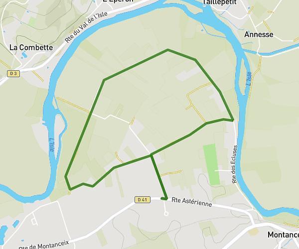
This running route covers 6.316mi starting from Saint-Astier, Dordogne. The run is a loop trail and returns to the trailhead. This run is rated as moderate, expect about 1h to complete it. The route has an elevation gain of 338ft and an elevation loss of 299ft.
Moblo
Route details
6.31mph
Speed
686 kcal
Calories burned
Loop trail
Route type
240ft
Min altitude
577ft
Max altitude
Route profile
338ft
Elevation gain
299ft
Elevation loss
240ft
Min altitude
577ft
Max altitude
How to get there
Trailhead: Route Du Val De L'isle, 24110 Saint-Astier
GPS coordinates of the trailhead: 45.15172, 0.53177 / 45°9'6'' N, 0°31'54'' E