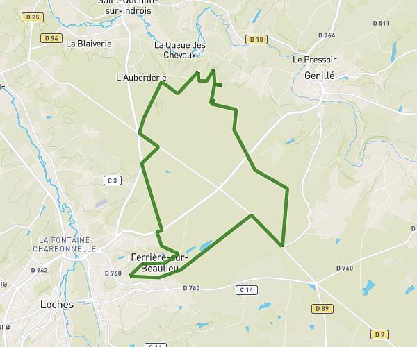
This running route covers 5.389mi starting from Beaulieu-lès-Loches, Indre-et-Loire. The run is a loop trail and returns to the trailhead. This run is rated as moderate, expect about 49m53s to complete it. The route has an elevation gain of 322ft and an elevation loss of 322ft.
8,67km Beaulieu
Route details
6.48mph
Speed
570 kcal
Calories burned
Loop trail
Route type
233ft
Min altitude
361ft
Max altitude
Route profile
322ft
Elevation gain
322ft
Elevation loss
233ft
Min altitude
361ft
Max altitude
How to get there
Trailhead: 2 Impasse Sainte-Catherine, 37600 Beaulieu-lès-Loches, France
GPS coordinates of the trailhead: 47.12742, 1.01301 / 47°7'38'' N, 1°0'46'' E