MapPlanner
7.621mi
Distance
2h47m
Duration
+997ft
Elevation gain
-997ft
Elevation loss
Hard
Level

rando lundi gab1

Route details

2.74mph
Speed
1217 kcal
Calories burned
5.0%
Avg grade
Loop trail
Route type
167ft
Min altitude
394ft
Max altitude

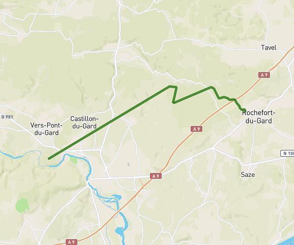
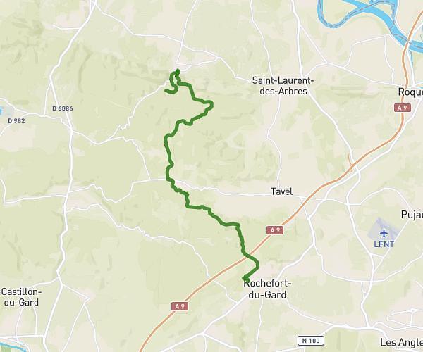
This hiking trail covers 7.621mi starting from Saze, Gard. The hike is a loop trail and returns to the trailhead. This hike is rated as hard, plan for about 2h47m to complete it. The route has an elevation gain of 997ft and an elevation loss of 997ft.

Route profile

997ft
Elevation gain
997ft
Elevation loss
167ft
Min altitude
394ft
Max altitude

How to get there

Trailhead: 18 Le Clos Du Castel, 30650 Saze, France

GPS coordinates of the trailhead: 43.943863, 4.684697 / 43°56'37'' N, 4°41'4'' E

Caution: May Cross Private Property

This route may pass through or near private property. Always respect posted signs, obtain permission where required, and follow local trespassing laws. MapPlanner does not guarantee public access along any route.

Safety Notice

Trail and road conditions may change without notice due to weather, construction, or other factors. Always verify current conditions before heading out. You are responsible for your own safety — follow local signage, obey traffic laws, and use your best judgment on the trail.