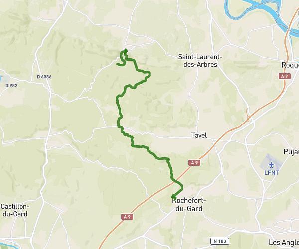
This hiking trail covers 15.826mi starting from Vers-Pont-du-Gard, Gard. The hike does not return to the trailhead and ends near Rue Arnaud Beltrame, 30650 Rochefort-du-Gard, France. This hike is rated as hard, plan for about 5h32m to complete it. The route has an elevation gain of 1522ft and an elevation loss of 1332ft.
Pré Treck 3
Route details
2.86mph
Speed
2397 kcal
Calories burned
3.4%
Avg grade
Point to point
Route type
141ft
Min altitude
686ft
Max altitude
Route profile
1522ft
Elevation gain
1332ft
Elevation loss
141ft
Min altitude
686ft
Max altitude
How to get there
Trailhead: Chemin De Valive, 30210 Vers-Pont-du-Gard, France
GPS coordinates of the trailhead: 43.950293, 4.526636 / 43°57'1'' N, 4°31'35'' E