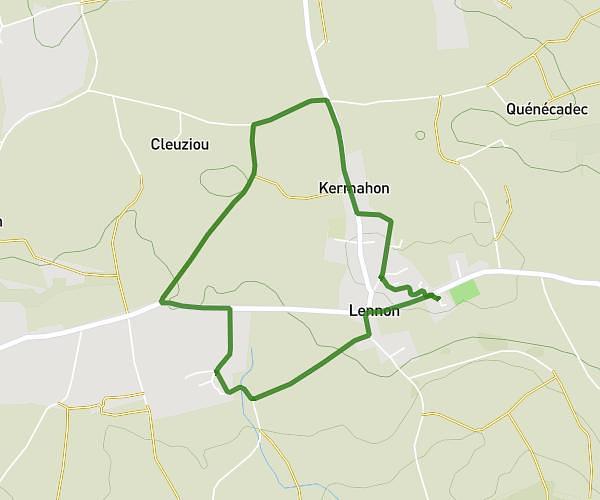
This running route covers 4.076mi starting from Lennon, Finistère. The run is a loop trail and returns to the trailhead. This run is rated as easy, expect about 39m to complete it. The route has an elevation gain of 249ft and an elevation loss of 243ft.
6.5km
Route details
6.27mph
Speed
446 kcal
Calories burned
Loop trail
Route type
292ft
Min altitude
407ft
Max altitude
Route profile
249ft
Elevation gain
243ft
Elevation loss
292ft
Min altitude
407ft
Max altitude
How to get there
Trailhead: 1 Lotissement De Belle Vue, 29190 Lennon, France
GPS coordinates of the trailhead: 48.19241, -3.89469 / 48°11'32'' N, 3°53'40'' W