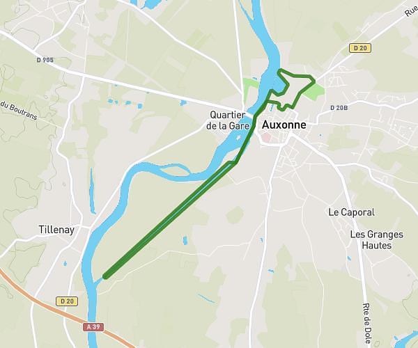
This running route covers 6.288mi starting from Côte-d’Or, Dijon. The run does not return to the trailhead and ends near 34 Cours Du Parc, 21000 Dijon, France. This run is rated as moderate, expect about 1h7m to complete it. The route has an elevation gain of 23ft and an elevation loss of 10ft.
Course 2026 n°2
Route details
5.63mph
Speed
766 kcal
Calories burned
Point to point
Route type
741ft
Min altitude
764ft
Max altitude
Route profile
23ft
Elevation gain
10ft
Elevation loss
741ft
Min altitude
764ft
Max altitude
How to get there
Trailhead: Allée Du Pas De Tir, 21000 Dijon, France
GPS coordinates of the trailhead: 47.29751, 5.04374 / 47°17'51'' N, 5°2'37'' E