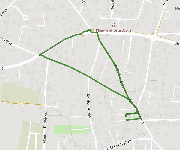
This hiking trail covers 2.638mi starting from Bordeaux, Gironde. The hike is a loop trail and returns to the trailhead. This hike is rated as easy, plan for about 57m to complete it. The route has an elevation gain of 200ft and an elevation loss of 197ft.
oct rose 2
Route details
2.78mph
Speed
409 kcal
Calories burned
2.9%
Avg grade
Loop trail
Route type
23ft
Min altitude
79ft
Max altitude
Route profile
200ft
Elevation gain
197ft
Elevation loss
23ft
Min altitude
79ft
Max altitude
How to get there
Trailhead: 29 Rue Colonel Jean Fleuret, 33000 Bordeaux, France
GPS coordinates of the trailhead: 44.836403, -0.585973 / 44°50'11'' N, 0°35'9'' W