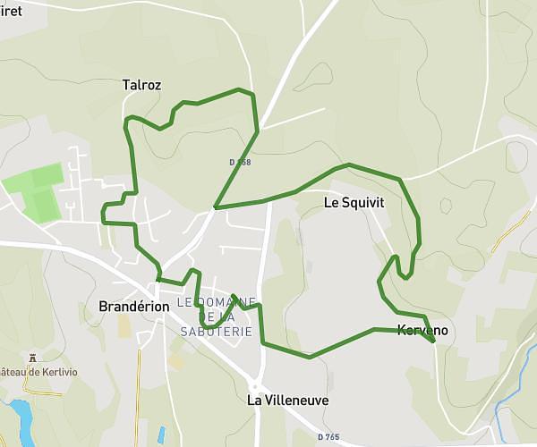
This running route covers 7.592mi starting from Lorient, Morbihan. The run is a loop trail and returns to the trailhead. This run is rated as hard, expect about 1h31m to complete it. The route has an elevation gain of 525ft and an elevation loss of 525ft.
2023/06/03
Route details
4.97mph
Speed
1048 kcal
Calories burned
Loop trail
Route type
-3ft
Min altitude
138ft
Max altitude
Route profile
525ft
Elevation gain
525ft
Elevation loss
-3ft
Min altitude
138ft
Max altitude
How to get there
Trailhead: Rue Amiral Favereau, 56100 Lorient
GPS coordinates of the trailhead: 47.76918, -3.37173 / 47°46'9'' N, 3°22'18'' W