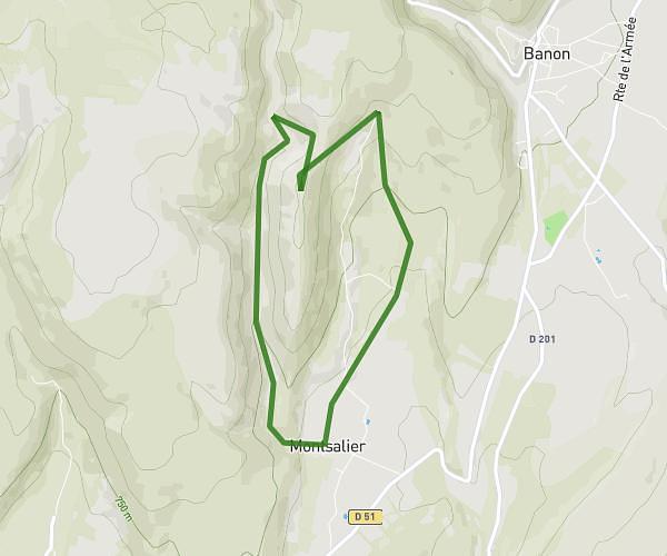
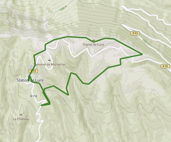
This hiking trail covers 15.876mi starting from Forcalquier, Alpes-de-Haute-Provence. The hike does not return to the trailhead and ends near Piste Du Sommet De Lure, 04230 Saint-Étienne-les-Orgues, France. This hike is rated as strenuous, plan for about 7h18m to complete it. The route has an elevation gain of 5148ft and an elevation loss of 1529ft.
test lure
Route details
2.17mph
Speed
3380 kcal
Calories burned
8.0%
Avg grade
Point to point
Route type
1775ft
Min altitude
5443ft
Max altitude
Steep climb
Route profile
5148ft
Elevation gain
1529ft
Elevation loss
1775ft
Min altitude
5443ft
Max altitude
How to get there
Trailhead: 12 Chemin De La Poudrière, 04300 Forcalquier, France
GPS coordinates of the trailhead: 43.963652, 5.786767 / 43°57'49'' N, 5°47'12'' E