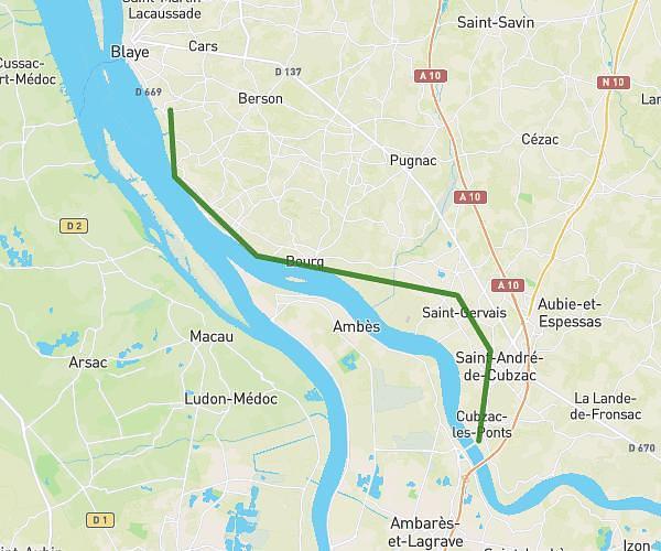
This hiking trail covers 3.175mi starting from Marcenais, Gironde. The hike is a loop trail and returns to the trailhead. This hike is rated as easy, plan for about 1h9m to complete it. The route has an elevation gain of 262ft and an elevation loss of 262ft.
boucle moulin charlot
Route details
2.76mph
Speed
496 kcal
Calories burned
3.1%
Avg grade
Loop trail
Route type
72ft
Min altitude
167ft
Max altitude
Route profile
262ft
Elevation gain
262ft
Elevation loss
72ft
Min altitude
167ft
Max altitude
How to get there
Trailhead: 508 Route Du Moulin, 33620 Marcenais, France
GPS coordinates of the trailhead: 45.063426, -0.329536 / 45°3'48'' N, 0°19'46'' W