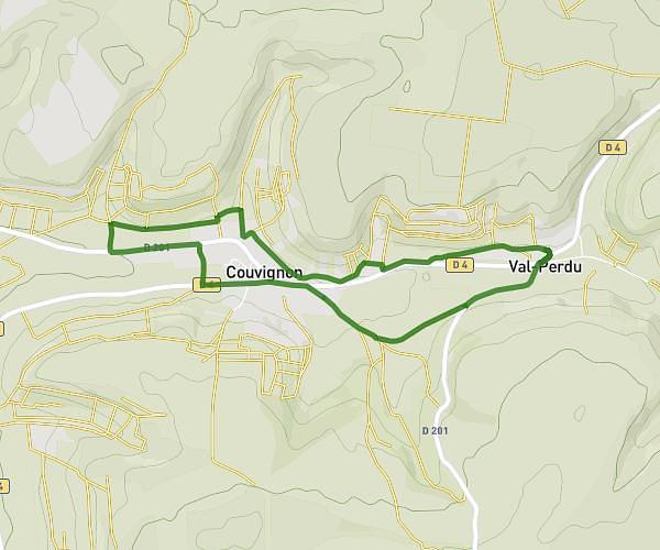
This walking route covers 3.677mi starting from Couvignon, Aube. The walk does not return to the trailhead and ends near 6 Rue De La Fontaine De La Pierre, 10200 Couvignon, France. This walk is rated as easy, plan for about 58m40s to complete it. The route has an elevation gain of 328ft and an elevation loss of 361ft.
Couvignon- Val Perdu - Couvignon
Route details
15:58/mi
Pace
240 kcal
Calories burned
Point to point
Route type
663ft
Min altitude
797ft
Max altitude
Route profile
328ft
Elevation gain
361ft
Elevation loss
663ft
Min altitude
797ft
Max altitude
How to get there
Trailhead: 1a Rue Notre-Dame-Des-Vignes, 10200 Couvignon, France
GPS coordinates of the trailhead: 48.20453, 4.65848 / 48°12'16'' N, 4°39'30'' E