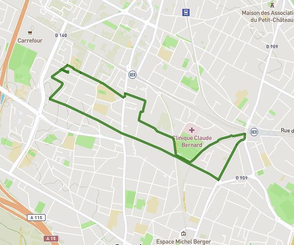
Explore this walking route of 7.55km starting from Nanterre, Hauts-de-Seine. The walk does not return to the starting point and ends near Avenue Du Colonel Hubert Delestrée, 92150 Suresnes. This walk is rated as very easy, plan for about 56m35s to complete it.
Description of the route by the creator
Health course