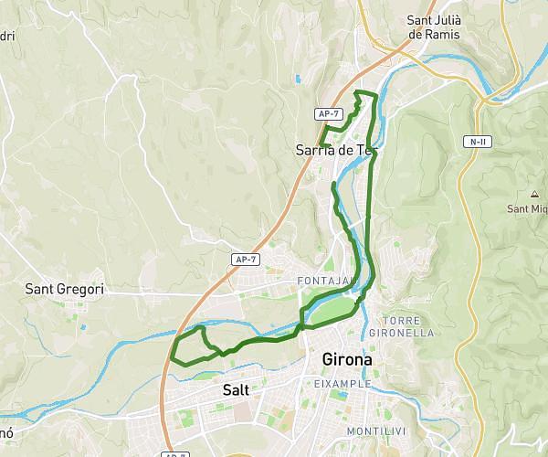
This running route covers 10.138mi starting from Sarrià de Ter, Girona. The run does not return to the trailhead and ends near Carrer Del Xunclà, 17840 Sarrià de Ter. This run is rated as hard, expect about 1h38m to complete it. The route has an elevation gain of 66ft and an elevation loss of 89ft.
16k via verda
Route details
6.21mph
Speed
1120 kcal
Calories burned
Point to point
Route type
200ft
Min altitude
272ft
Max altitude
Route profile
66ft
Elevation gain
89ft
Elevation loss
200ft
Min altitude
272ft
Max altitude
How to get there
Trailhead: Plaça De La Vila Romana, 17840 Sarrià de Ter
GPS coordinates of the trailhead: 42.01522, 2.81557 / 42°0'54'' N, 2°48'56'' E