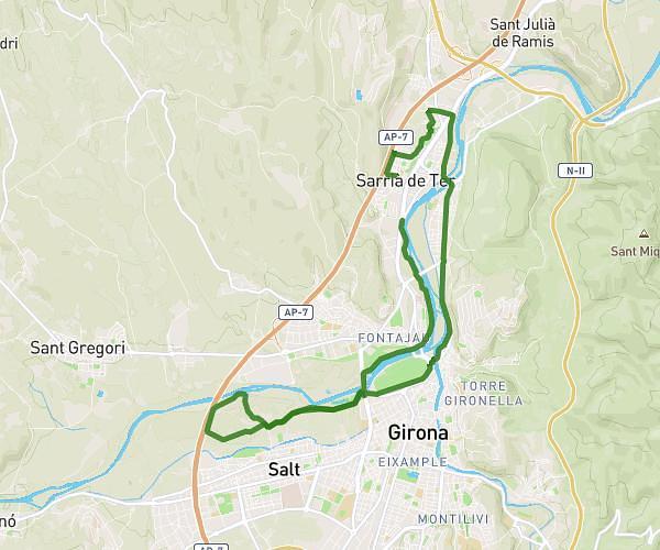
This running route covers 3.752mi starting from Sarrià de Ter, Girona. The run is a loop trail and returns to the trailhead. This run is rated as easy, expect about 1h12m to complete it. The route has an elevation gain of 203ft and an elevation loss of 203ft.
6k schnell
Route details
3.11mph
Speed
829 kcal
Calories burned
Loop trail
Route type
200ft
Min altitude
269ft
Max altitude
Route profile
203ft
Elevation gain
203ft
Elevation loss
200ft
Min altitude
269ft
Max altitude
How to get there
Trailhead: Passeig De Federico García Lorca, 17840 Sarrià de Ter
GPS coordinates of the trailhead: 42.01484, 2.81565 / 42°0'53'' N, 2°48'56'' E