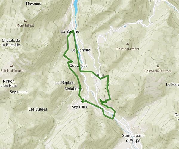
This running route covers 11.477mi starting from Habère-Poche, Haute-Savoie. The run is a loop trail and returns to the trailhead. This run is rated as strenuous, expect about 2h3m to complete it. The route has an elevation gain of 2461ft and an elevation loss of 2467ft.
Arces Lullin Hirmentaz
Route details
5.59mph
Speed
1408 kcal
Calories burned
Loop trail
Route type
2930ft
Min altitude
4055ft
Max altitude
Route profile
2461ft
Elevation gain
2467ft
Elevation loss
2930ft
Min altitude
4055ft
Max altitude
How to get there
Trailhead: 11 Route Du Plan De Poche, 74420 Habère-Poche, France
GPS coordinates of the trailhead: 46.247678, 6.475377 / 46°14'51'' N, 6°28'31'' E