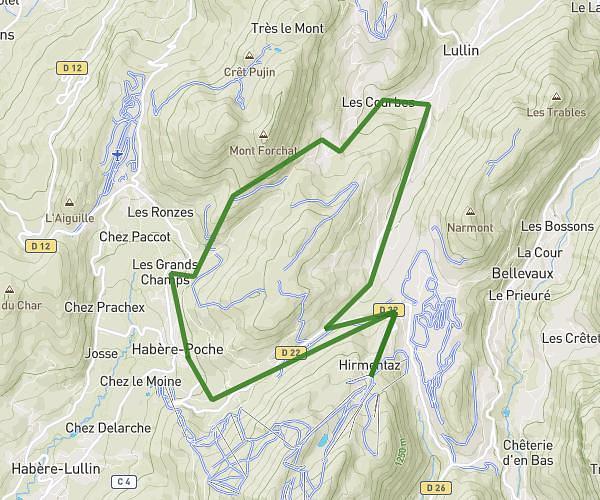
This running route covers 10.034mi starting from La Baume, Haute-Savoie. The run is a loop trail and returns to the trailhead. This run is rated as hard, expect about 2h18m to complete it. The route has an elevation gain of 2178ft and an elevation loss of 2169ft.
La baume /le biot /st jean d'aulps /la baume
Route details
4.35mph
Speed
1582 kcal
Calories burned
Loop trail
Route type
2178ft
Min altitude
3576ft
Max altitude
Route profile
2178ft
Elevation gain
2169ft
Elevation loss
2178ft
Min altitude
3576ft
Max altitude
How to get there
Trailhead: 789 Voie À Manon, 74430 La Baume, France
GPS coordinates of the trailhead: 46.27582, 6.61193 / 46°16'32'' N, 6°36'42'' E