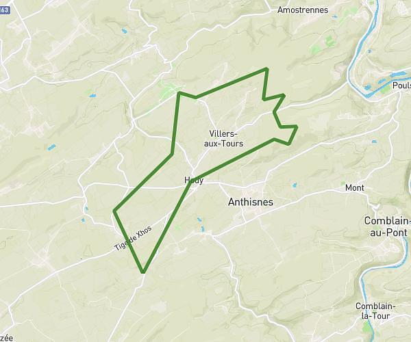
This hiking trail covers 7.253mi starting from Anthisnes, Liege. The hike is a loop trail and returns to the trailhead. This hike is rated as moderate, plan for about 2h45m to complete it. The route has an elevation gain of 781ft and an elevation loss of 784ft.
Hody 10km
Route details
2.63mph
Speed
1194 kcal
Calories burned
4.1%
Avg grade
Loop trail
Route type
696ft
Min altitude
968ft
Max altitude
Route profile
781ft
Elevation gain
784ft
Elevation loss
696ft
Min altitude
968ft
Max altitude
How to get there
Trailhead: Chemin Du Sart, 4162 Anthisnes, Liege, Belgium
GPS coordinates of the trailhead: 50.48654, 5.50057 / 50°29'11'' N, 5°30'2'' E