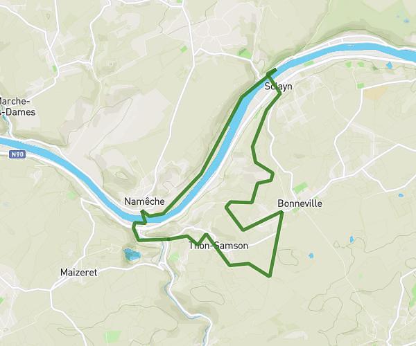
This hiking trail covers 6.807mi starting from Braives, Liege. The hike is a loop trail and returns to the trailhead. This hike is rated as moderate, plan for about 2h34m to complete it. The route has an elevation gain of 833ft and an elevation loss of 801ft.
test de 11 km autourde Fumal
Route details
2.65mph
Speed
1120 kcal
Calories burned
4.5%
Avg grade
Loop trail
Route type
315ft
Min altitude
554ft
Max altitude
Route profile
833ft
Elevation gain
801ft
Elevation loss
315ft
Min altitude
554ft
Max altitude
How to get there
Trailhead: Rue Sous-Moson 14, 4260 Braives, Liege, Belgium
GPS coordinates of the trailhead: 50.581313, 5.18407 / 50°34'52'' N, 5°11'2'' E