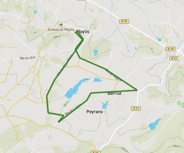
This hiking trail covers 5.156mi starting from Monget, Landes. The hike is a loop trail and returns to the trailhead. This hike is rated as moderate, plan for about 2h4m to complete it. The route has an elevation gain of 669ft and an elevation loss of 669ft.
8KM - FETES DE MONGET 2025
Route details
2.49mph
Speed
907 kcal
Calories burned
4.9%
Avg grade
Loop trail
Route type
240ft
Min altitude
509ft
Max altitude
Route profile
669ft
Elevation gain
669ft
Elevation loss
240ft
Min altitude
509ft
Max altitude
How to get there
Trailhead: 95 Route De Montagut, 40700 Monget, France
GPS coordinates of the trailhead: 43.566, -0.51846 / 43°33'57'' N, 0°31'6'' W