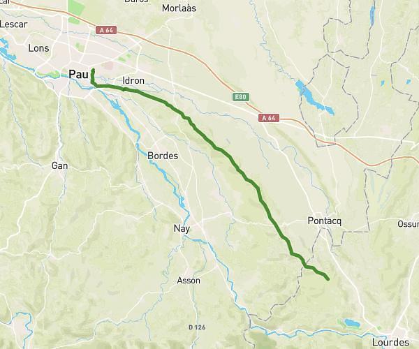
This hiking trail covers 18.531mi starting from Pau, Pyrénées-Atlantiques. The hike does not return to the trailhead and ends near 140 Chemin Des Pyrénées, 64410 Vignes, France. This hike is rated as hard, plan for about 6h15m to complete it. The route has an elevation gain of 997ft and an elevation loss of 925ft.
Arzacq
Route details
2.96mph
Speed
2670 kcal
Calories burned
2.0%
Avg grade
Point to point
Route type
335ft
Min altitude
912ft
Max altitude
Route profile
997ft
Elevation gain
925ft
Elevation loss
335ft
Min altitude
912ft
Max altitude
How to get there
Trailhead: Passerelle Du Zénith, 64000 Pau, France
GPS coordinates of the trailhead: 43.33635, -0.363 / 43°20'10'' N, 0°21'46'' W