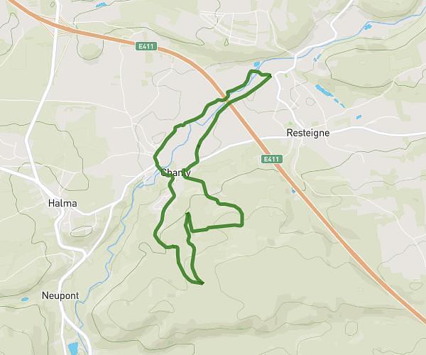
This running route covers 1.617mi starting from Wellin, Luxembourg. The run is a loop trail and returns to the trailhead. This run is rated as easy, expect about 16m to complete it. The route has an elevation gain of 384ft and an elevation loss of 384ft.
2,6 km || Bois Chanly
Route details
6.06mph
Speed
183 kcal
Calories burned
Loop trail
Route type
636ft
Min altitude
1020ft
Max altitude
Route profile
384ft
Elevation gain
384ft
Elevation loss
636ft
Min altitude
1020ft
Max altitude
How to get there
Trailhead: Rue De Mirwart, 6921 Wellin
GPS coordinates of the trailhead: 50.07887, 5.15714 / 50°4'43'' N, 5°9'25'' E