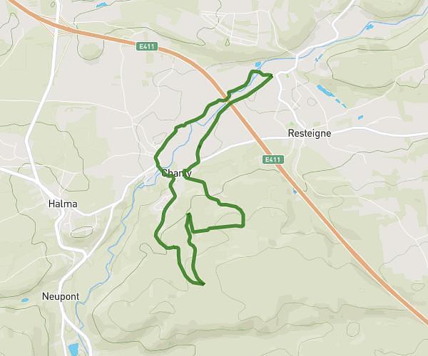
This running route covers 2.492mi starting from Wellin, Luxembourg. The run is a loop trail and returns to the trailhead. This run is rated as easy, expect about 24m to complete it. The route has an elevation gain of 167ft and an elevation loss of 167ft.
4 km || Chanly - Resteigne
Route details
6.23mph
Speed
274 kcal
Calories burned
Loop trail
Route type
600ft
Min altitude
663ft
Max altitude
Route profile
167ft
Elevation gain
167ft
Elevation loss
600ft
Min altitude
663ft
Max altitude
How to get there
Trailhead: Route De La Falloise, 6921 Wellin
GPS coordinates of the trailhead: 50.08159, 5.15994 / 50°4'53'' N, 5°9'35'' E