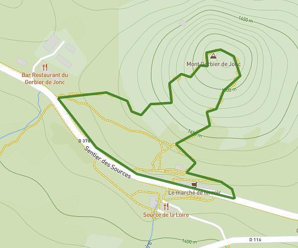
This hiking trail covers 2.001mi starting from Saint-Martial, Ardèche. The hike is a loop trail and returns to the trailhead. This hike is rated as easy, plan for about 21m to complete it. The route has an elevation gain of 289ft and an elevation loss of 292ft.
Sentier des Sources
Route details
5.72mph
Speed
154 kcal
Calories burned
5.5%
Avg grade
Loop trail
Route type
4446ft
Min altitude
4649ft
Max altitude
Route profile
289ft
Elevation gain
292ft
Elevation loss
4446ft
Min altitude
4649ft
Max altitude
How to get there
Trailhead: 304 Route Des Sources De La Loire, 07310 Saint-Martial, France
GPS coordinates of the trailhead: 44.841836, 4.218908 / 44°50'30'' N, 4°13'8'' E