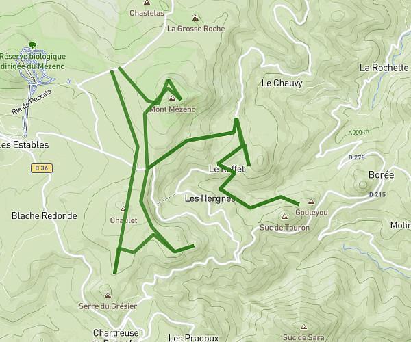
This hiking trail covers 3.882mi starting from Solignac-sur-Loire, Haute-Loire. The hike is a loop trail and returns to the trailhead. This hike is rated as hard, plan for about 37m to complete it. The route has an elevation gain of 1201ft and an elevation loss of 1204ft.
Cascade beaume
Route details
6.29mph
Speed
284 kcal
Calories burned
11.7%
Avg grade
Loop trail
Route type
2369ft
Min altitude
2864ft
Max altitude
Steep climb
Route profile
1201ft
Elevation gain
1204ft
Elevation loss
2369ft
Min altitude
2864ft
Max altitude
How to get there
Trailhead: 1 Chemin De Roche Moulin, 43370 Solignac-sur-Loire, France
GPS coordinates of the trailhead: 44.95278, 3.91228 / 44°57'10'' N, 3°54'44'' E