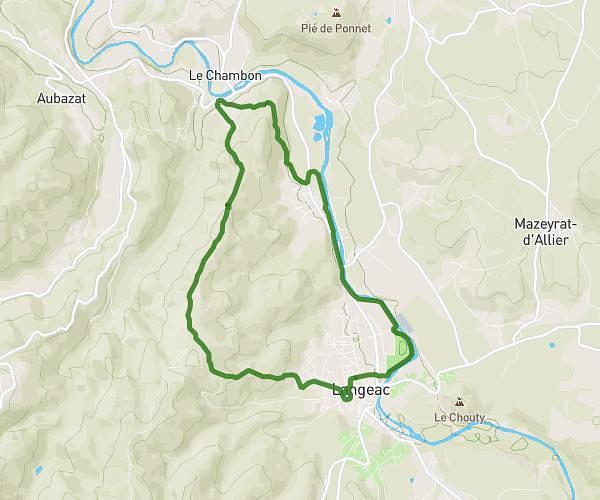
This hiking trail covers 5.689mi starting from Beaulieu, Haute-Loire. The hike is a loop trail and returns to the trailhead. This hike is rated as moderate, plan for about 2h36m to complete it. The route has an elevation gain of 873ft and an elevation loss of 876ft.
meaux serville la chazorne
Route details
2.17mph
Speed
1152 kcal
Calories burned
5.8%
Avg grade
Loop trail
Route type
1818ft
Min altitude
2142ft
Max altitude
Route profile
873ft
Elevation gain
876ft
Elevation loss
1818ft
Min altitude
2142ft
Max altitude
How to get there
Trailhead: 1732 Route Du Pont De Margeaix, 43800 Beaulieu, France
GPS coordinates of the trailhead: 45.138273, 3.930076 / 45°8'17'' N, 3°55'48'' E