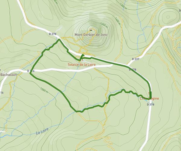
This hiking trail covers 0.804mi starting from Sainte-Eulalie, Ardèche. The hike is a loop trail and returns to the trailhead. This hike is rated as easy, plan for about 14m to complete it. The route has an elevation gain of 377ft and an elevation loss of 377ft.
Sommet du Gerbier de Jonc
Route details
3.45mph
Speed
113 kcal
Calories burned
17.8%
Avg grade
Loop trail
Route type
4639ft
Min altitude
4993ft
Max altitude
Steep climb
Route profile
377ft
Elevation gain
377ft
Elevation loss
4639ft
Min altitude
4993ft
Max altitude
How to get there
Trailhead: 4739 Sentier Des Sources, 07510 Sainte-Eulalie, France
GPS coordinates of the trailhead: 44.841566, 4.220345 / 44°50'29'' N, 4°13'13'' E