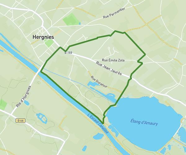
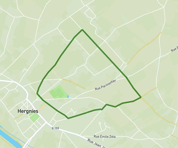
This walking route covers 2.144mi starting from Saint-Ghislain, Hainaut. The walk is a loop trail and returns to the trailhead. This walk is rated as easy, plan for about 46m16s to complete it. The route has an elevation gain of 59ft and an elevation loss of 59ft.
Marche Halloween 2
Route details
19:19/mi
Pace
189 kcal
Calories burned
Loop trail
Route type
207ft
Min altitude
253ft
Max altitude
Route profile
59ft
Elevation gain
59ft
Elevation loss
207ft
Min altitude
253ft
Max altitude
How to get there
Trailhead: Rue Émile Lété 30, 7332 Saint-Ghislain, Hainaut, Belgium
GPS coordinates of the trailhead: 50.50633, 3.79581 / 50°30'22'' N, 3°47'44'' E