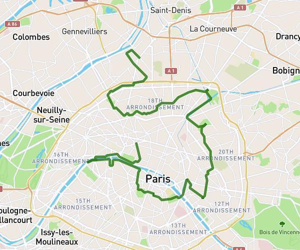
This hiking trail covers 5.118mi starting from Île-de-France, Paris. The hike does not return to the trailhead and ends near Boulevard Du Palais, 75004 Paris. This hike is rated as moderate, plan for about 2h10m to complete it. The route has an elevation gain of 522ft and an elevation loss of 574ft.
Paris
Route details
2.36mph
Speed
939 kcal
Calories burned
4.1%
Avg grade
Point to point
Route type
105ft
Min altitude
210ft
Max altitude
Route profile
522ft
Elevation gain
574ft
Elevation loss
105ft
Min altitude
210ft
Max altitude
How to get there
Trailhead: Avenue Des Champs-Élysées, 75008 Paris
GPS coordinates of the trailhead: 48.87263, 2.29931 / 48°52'21'' N, 2°17'57'' E