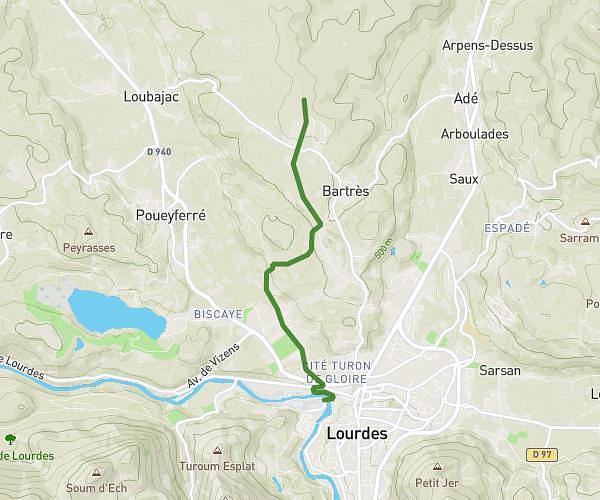
This hiking trail covers 10.024mi starting from Luz-Saint-Sauveur, Hautes-Pyrénées. The hike does not return to the trailhead and ends near Impasse Du Soum Blanc, 65120 Gavarnie-Gèdre, France. This hike is rated as strenuous, plan for about 5h40m to complete it. The route has an elevation gain of 3848ft and an elevation loss of 2461ft.
Etape 1
Route details
1.77mph
Speed
2668 kcal
Calories burned
11.9%
Avg grade
Point to point
Route type
2369ft
Min altitude
4610ft
Max altitude
Steep climb
Route profile
3848ft
Elevation gain
2461ft
Elevation loss
2369ft
Min altitude
4610ft
Max altitude
How to get there
Trailhead: 24 Place Saint-Clément, 65120 Luz-Saint-Sauveur, France
GPS coordinates of the trailhead: 42.870951, -0.003519 / 42°52'15'' N, 0°0'12'' W