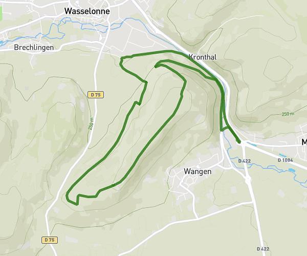
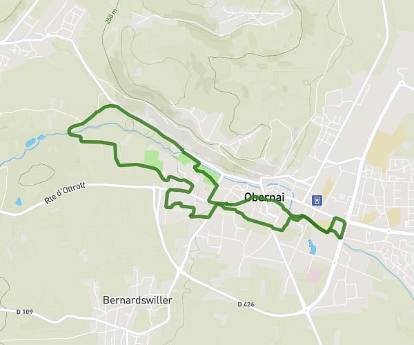
This running route covers 5.708mi starting from Ottrott, Bas-Rhin. The run is a loop trail and returns to the trailhead. This run is rated as moderate, expect about 55m to complete it. The route has an elevation gain of 1155ft and an elevation loss of 1155ft.
2-3 23/05/05
Route details
6.23mph
Speed
629 kcal
Calories burned
Loop trail
Route type
1030ft
Min altitude
1768ft
Max altitude
Route profile
1155ft
Elevation gain
1155ft
Elevation loss
1030ft
Min altitude
1768ft
Max altitude
How to get there
Trailhead: 14 Rue Lerchenberg, 67530 Ottrott, France
GPS coordinates of the trailhead: 48.46638, 7.41309 / 48°27'58'' N, 7°24'47'' E