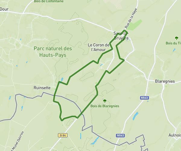
This hiking trail covers 6.698mi starting from Grand-Fayt, Nord. The hike is a loop trail and returns to the trailhead. This hike is rated as easy, plan for about 1h47m to complete it. The route has an elevation gain of 328ft and an elevation loss of 331ft.
Grand Fayt _Bis
Route details
3.73mph
Speed
766 kcal
Calories burned
1.9%
Avg grade
Loop trail
Route type
456ft
Min altitude
627ft
Max altitude
Route profile
328ft
Elevation gain
331ft
Elevation loss
456ft
Min altitude
627ft
Max altitude
How to get there
Trailhead: 2 Rue Du Moulin, 59244 Grand-Fayt, France
GPS coordinates of the trailhead: 50.11267, 3.80387 / 50°6'45'' N, 3°48'13'' E