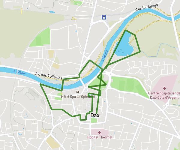
This walking route covers 4.166mi starting from Dax, Landes. The walk does not return to the trailhead and ends near Quai Raphaël Milliès-Lacroix, 40100 Dax, France. This walk is rated as moderate, plan for about 1h29m to complete it. The route has an elevation gain of 203ft and an elevation loss of 200ft.
Dax St Vincent
Route details
21:22/mi
Pace
363 kcal
Calories burned
Point to point
Route type
10ft
Min altitude
89ft
Max altitude
Route profile
203ft
Elevation gain
200ft
Elevation loss
10ft
Min altitude
89ft
Max altitude
How to get there
Trailhead: Boulevard Yves Du Manoir, 40100 Dax, France
GPS coordinates of the trailhead: 43.712518, -1.046469 / 43°42'45'' N, 1°2'47'' W