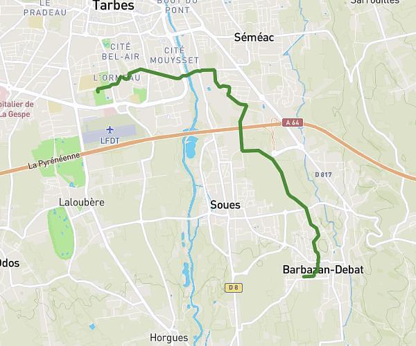
This running route covers 12.857mi starting from Séméac, Hautes-Pyrénées. The run is a loop trail and returns to the trailhead. This run is rated as strenuous, expect about 2h15m to complete it. The route has an elevation gain of 807ft and an elevation loss of 807ft.
Semi
Route details
5.72mph
Speed
1544 kcal
Calories burned
Loop trail
Route type
1063ft
Min altitude
1588ft
Max altitude
Route profile
807ft
Elevation gain
807ft
Elevation loss
1063ft
Min altitude
1588ft
Max altitude
How to get there
Trailhead: Rue Du Reyen, 65600 Séméac
GPS coordinates of the trailhead: 43.2195, 0.10908 / 43°13'10'' N, 0°6'32'' E