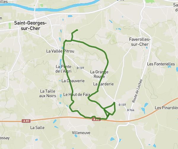
This running route covers 2.532mi starting from Seigy, Loir-et-Cher. The run is a loop trail and returns to the trailhead. This run is rated as easy, expect about 24m to complete it. The route has an elevation gain of 246ft and an elevation loss of 246ft.
la grand chardon
Route details
6.33mph
Speed
274 kcal
Calories burned
Loop trail
Route type
249ft
Min altitude
427ft
Max altitude
Route profile
246ft
Elevation gain
246ft
Elevation loss
249ft
Min altitude
427ft
Max altitude
How to get there
Trailhead: Rue Du Carroir, 41110 Seigy
GPS coordinates of the trailhead: 47.25826, 1.3818 / 47°15'29'' N, 1°22'54'' E