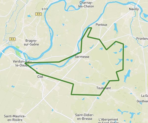
This running route covers 8.328mi starting from Ciel, Saône-et-Loire. The run is a loop trail and returns to the trailhead. This run is rated as hard, expect about 1h29m to complete it. The route has an elevation gain of 10ft and an elevation loss of 10ft.
dimanche
Route details
5.62mph
Speed
1018 kcal
Calories burned
Loop trail
Route type
564ft
Min altitude
574ft
Max altitude
Route profile
10ft
Elevation gain
10ft
Elevation loss
564ft
Min altitude
574ft
Max altitude
How to get there
Trailhead: 28 Route De Verdun, 71350 Ciel, France
GPS coordinates of the trailhead: 46.887011, 5.03797 / 46°53'13'' N, 5°2'16'' E