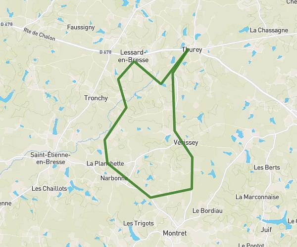
This running route covers 6.027mi starting from Montret, Saône-et-Loire. The run is a loop trail and returns to the trailhead. This run is rated as moderate, expect about 1h9m to complete it. The route has an elevation gain of 322ft and an elevation loss of 325ft.
St André
Route details
5.24mph
Speed
789 kcal
Calories burned
Loop trail
Route type
597ft
Min altitude
682ft
Max altitude
Route profile
322ft
Elevation gain
325ft
Elevation loss
597ft
Min altitude
682ft
Max altitude
How to get there
Trailhead: 60 Impasse De Charmoissy, 71440 Montret, France
GPS coordinates of the trailhead: 46.668248, 5.110805 / 46°40'5'' N, 5°6'38'' E