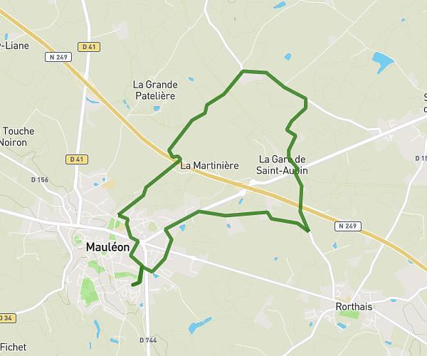
This hiking trail covers 9.736mi starting from Melle, Deux-Sèvres. The hike is a loop trail and returns to the trailhead. This hike is rated as moderate, plan for about 3h55m to complete it. The route has an elevation gain of 548ft and an elevation loss of 551ft.
Melle La Martinière Le Quaireux Melle
Route details
2.49mph
Speed
1674 kcal
Calories burned
2.1%
Avg grade
Loop trail
Route type
348ft
Min altitude
568ft
Max altitude
Route profile
548ft
Elevation gain
551ft
Elevation loss
348ft
Min altitude
568ft
Max altitude
How to get there
Trailhead: 14 Place Bujault, 79500 Melle, France
GPS coordinates of the trailhead: 46.222542, -0.14354 / 46°13'21'' N, 0°8'36'' W