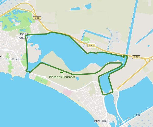
This running route covers 5.369mi starting from Le Grau-du-Roi, Gard. The run is a loop trail and returns to the trailhead. This run is rated as moderate, expect about 57m36s to complete it. The route has an elevation gain of 95ft and an elevation loss of 98ft.
St Just Do It : Ponant 8,6 km-14133489
Route details
5.59mph
Speed
659 kcal
Calories burned
Loop trail
Route type
-10ft
Min altitude
16ft
Max altitude
Route profile
95ft
Elevation gain
98ft
Elevation loss
-10ft
Min altitude
16ft
Max altitude
How to get there
Trailhead: 1551 Route De Carnon, 30240 Le Grau-du-Roi, France
GPS coordinates of the trailhead: 43.55611, 4.10242 / 43°33'21'' N, 4°6'8'' E