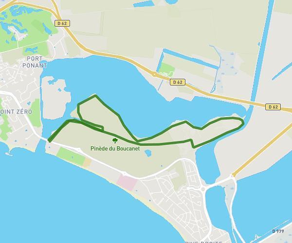
This running route covers 7.83mi starting from La Grande-Motte, Hérault. The run is a loop trail and returns to the trailhead. This run is rated as hard, expect about 1h24m to complete it. The route has an elevation gain of 118ft and an elevation loss of 115ft.
St JustDoIt : Tour ponant 12,6 km-4744315
Route details
5.59mph
Speed
960 kcal
Calories burned
Loop trail
Route type
0ft
Min altitude
20ft
Max altitude
Route profile
118ft
Elevation gain
115ft
Elevation loss
0ft
Min altitude
20ft
Max altitude
How to get there
Trailhead: Avenue Maréchal Leclerc, 34280 La Grande-Motte, France
GPS coordinates of the trailhead: 43.55654, 4.10052 / 43°33'23'' N, 4°6'1'' E