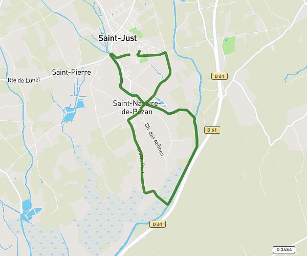
This running route covers 4.445mi starting from Vergèze, Gard. The run does not return to the trailhead and ends near 1 Mas Ravier, 30600 Vestric-et-Candiac, France. This run is rated as easy, expect about 53m38s to complete it. The route has an elevation gain of 3ft and an elevation loss of 7ft.
Vergèze
Route details
4.97mph
Speed
613 kcal
Calories burned
Point to point
Route type
46ft
Min altitude
52ft
Max altitude
Route profile
3ft
Elevation gain
7ft
Elevation loss
46ft
Min altitude
52ft
Max altitude
How to get there
Trailhead: 1325 Lieu Dit Les Bouillens, 30310 Vergèze, France
GPS coordinates of the trailhead: 43.7339, 4.2455 / 43°44'2'' N, 4°14'43'' E