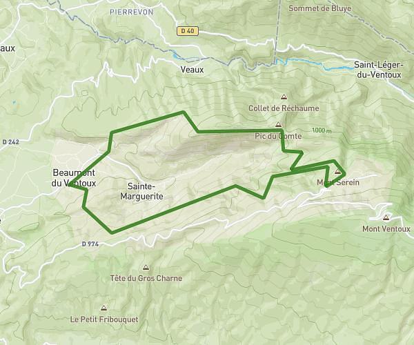
This running route covers 12.663mi starting from Saint-Pierre-de-Vassols, Vaucluse. The run is a loop trail and returns to the trailhead. This run is rated as strenuous, expect about 2h15m to complete it. The route has an elevation gain of 259ft and an elevation loss of 282ft.
Serres
Route details
5.59mph
Speed
1553 kcal
Calories burned
Loop trail
Route type
410ft
Min altitude
689ft
Max altitude
Route profile
259ft
Elevation gain
282ft
Elevation loss
410ft
Min altitude
689ft
Max altitude
How to get there
Trailhead: La Venue De Mormoiron, 84330 Saint-Pierre-de-Vassols
GPS coordinates of the trailhead: 44.09633, 5.14318 / 44°5'46'' N, 5°8'35'' E