MapPlanner
5.925mi
Distance
2h2m
Duration
+302ft
Elevation gain
-302ft
Elevation loss
Easy
Level

Fresville

Route details

2.91mph
Speed
868 kcal
Calories burned
1.9%
Avg grade
Loop trail
Route type
7ft
Min altitude
85ft
Max altitude

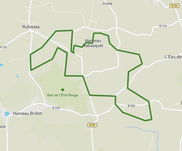
This hiking trail covers 5.925mi starting from Écausseville, Manche. The hike is a loop trail and returns to the trailhead. This hike is rated as easy, plan for about 2h2m to complete it. The route has an elevation gain of 302ft and an elevation loss of 302ft.

Route profile

302ft
Elevation gain
302ft
Elevation loss
7ft
Min altitude
85ft
Max altitude

How to get there

Trailhead: 4 Hameau La Lande, 50310 Écausseville, France

GPS coordinates of the trailhead: 49.457976, -1.386483 / 49°27'28'' N, 1°23'11'' W

Caution: May Cross Private Property

This route may pass through or near private property. Always respect posted signs, obtain permission where required, and follow local trespassing laws. MapPlanner does not guarantee public access along any route.

Safety Notice

Trail and road conditions may change without notice due to weather, construction, or other factors. Always verify current conditions before heading out. You are responsible for your own safety — follow local signage, obey traffic laws, and use your best judgment on the trail.