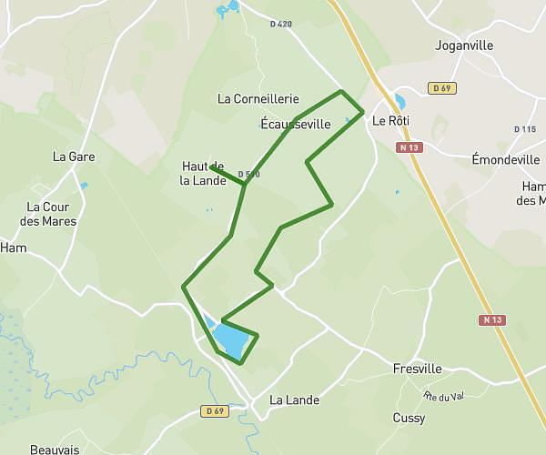
This hiking trail covers 6.864mi starting from Saussemesnil, Manche. The hike is a loop trail and returns to the trailhead. This hike is rated as moderate, plan for about 3h20m to complete it. The route has an elevation gain of 712ft and an elevation loss of 709ft.
Ruffosses
Route details
2.06mph
Speed
1446 kcal
Calories burned
3.9%
Avg grade
Loop trail
Route type
226ft
Min altitude
413ft
Max altitude
Route profile
712ft
Elevation gain
709ft
Elevation loss
226ft
Min altitude
413ft
Max altitude
How to get there
Trailhead: D 87, 50700 Saussemesnil, France
GPS coordinates of the trailhead: 49.57002, -1.4982 / 49°34'12'' N, 1°29'53'' W