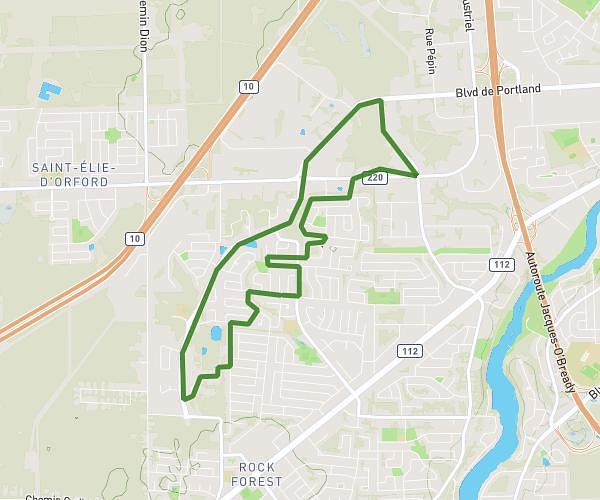
This running route covers 7.169mi starting from Sherbrooke, Quebec. The run is a loop trail and returns to the trailhead. This run is rated as moderate, expect about 1h17m to complete it. The route has an elevation gain of 13ft and an elevation loss of 26ft.
Boucle lac des nations et axe Magog
Route details
5.59mph
Speed
880 kcal
Calories burned
Loop trail
Route type
577ft
Min altitude
604ft
Max altitude
Route profile
13ft
Elevation gain
26ft
Elevation loss
577ft
Min altitude
604ft
Max altitude
How to get there
Trailhead: 911 Rue De L'esplanade, Sherbrooke, Quebec J1H 1S9, Canada
GPS coordinates of the trailhead: 45.39759, -71.90224 / 45°23'51'' N, 71°54'8'' W