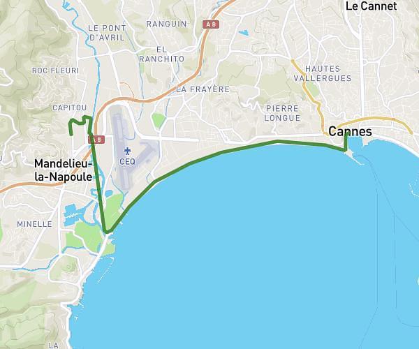
This walking route covers 1.935mi starting from Cannes, Alpes-Maritimes. The walk does not return to the trailhead and ends near 133 Boulevard De La Croisette, 06400 Cannes, France. This walk is rated as easy, plan for about 21m to complete it. The route has an elevation gain of 151ft and an elevation loss of 161ft.
Mairie de cannes Pointe croisette
Route details
10:51/mi
Pace
86 kcal
Calories burned
Point to point
Route type
3ft
Min altitude
39ft
Max altitude
Route profile
151ft
Elevation gain
161ft
Elevation loss
3ft
Min altitude
39ft
Max altitude
How to get there
Trailhead: Promenade De La Pantiero, 06400 Cannes, France
GPS coordinates of the trailhead: 43.550912, 7.012488 / 43°33'3'' N, 7°0'44'' E