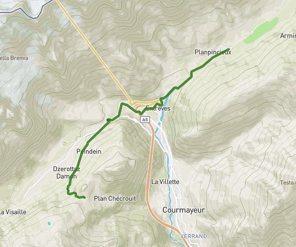
This hiking trail covers 9.953mi starting from Chamonix-Mont-Blanc, Haute-Savoie. The hike does not return to the trailhead and ends near 81 Rue De L'église, 74310 Les Houches, France. This hike is rated as moderate, plan for about 3h30m to complete it. The route has an elevation gain of 262ft and an elevation loss of 974ft.
J6 Argentieres Les houches
Route details
2.85mph
Speed
1482 kcal
Calories burned
2.4%
Avg grade
Point to point
Route type
3264ft
Min altitude
4032ft
Max altitude
Route profile
262ft
Elevation gain
974ft
Elevation loss
3264ft
Min altitude
4032ft
Max altitude
How to get there
Trailhead: 181 Chemin Des Chosalets, 74400 Chamonix-Mont-Blanc, France
GPS coordinates of the trailhead: 45.97465, 6.92412 / 45°58'28'' N, 6°55'26'' E