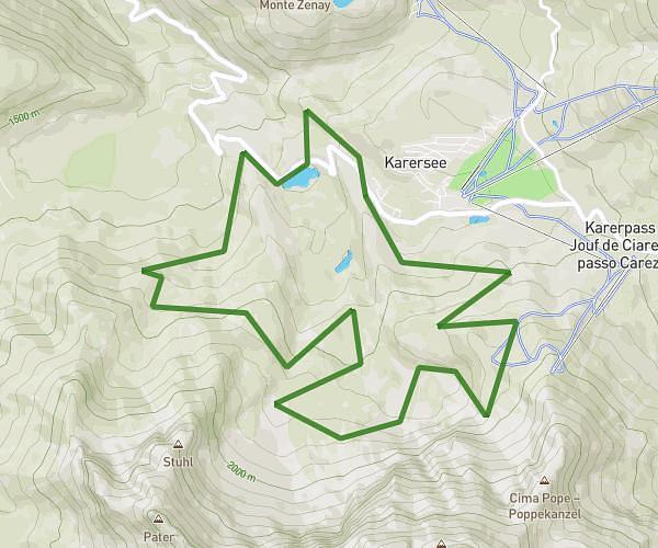
This hiking trail covers 4.161mi starting from Nova Levante, South Tyrol. The hike is a loop trail and returns to the trailhead. This hike is rated as hard, plan for about 1h40m to complete it. The route has an elevation gain of 1109ft and an elevation loss of 1083ft.
Rund um den Zenayberg
Route details
2.49mph
Speed
762 kcal
Calories burned
10.0%
Avg grade
Loop trail
Route type
5016ft
Min altitude
5528ft
Max altitude
Steep climb
Route profile
1109ft
Elevation gain
1083ft
Elevation loss
5016ft
Min altitude
5528ft
Max altitude
How to get there
Trailhead: Schönblickweg - Via Bellavista 9, 39056 Nova Levante South Tyrol, Italy
GPS coordinates of the trailhead: 46.41737, 11.57514 / 46°25'2'' N, 11°34'30'' E