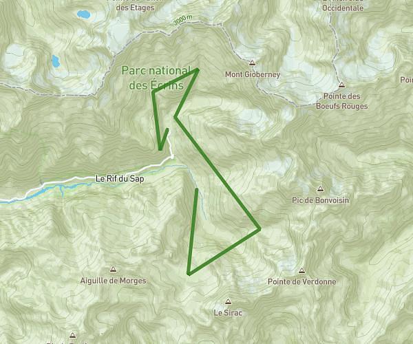
This running route covers 9.829mi starting from La Roche-de-Rame, Hautes-Alpes. The run is a loop trail and returns to the trailhead. This run is rated as hard, expect about 2h40m to complete it. The route has an elevation gain of 4049ft and an elevation loss of 4042ft.
Tour du soir
Route details
3.68mph
Speed
1829 kcal
Calories burned
Loop trail
Route type
3186ft
Min altitude
4872ft
Max altitude
Route profile
4049ft
Elevation gain
4042ft
Elevation loss
3186ft
Min altitude
4872ft
Max altitude
How to get there
Trailhead: 120 Chemin Des Bruns, 05310 La Roche-de-Rame, France
GPS coordinates of the trailhead: 44.759604, 6.579541 / 44°45'34'' N, 6°34'46'' E