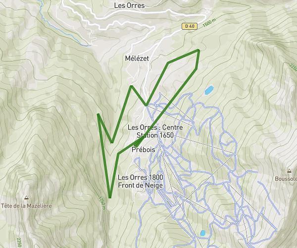
This running route covers 6.619mi starting from Les Orres, Hautes-Alpes. The run is a loop trail and returns to the trailhead. This run is rated as moderate, expect about 1h3m to complete it. The route has an elevation gain of 1722ft and an elevation loss of 1696ft.
Sortie vallonne les Orres 1h
Route details
6.21mph
Speed
731 kcal
Calories burned
Loop trail
Route type
4731ft
Min altitude
5466ft
Max altitude
Route profile
1722ft
Elevation gain
1696ft
Elevation loss
4731ft
Min altitude
5466ft
Max altitude
How to get there
Trailhead: 4 Route De Bois Méan, 05200 Les Orres, France
GPS coordinates of the trailhead: 44.490666, 6.552365 / 44°29'26'' N, 6°33'8'' E